
The same system that brings periods of rain, gusty wind, cold weather and brief snow to parts of our area will become a full-blown blizzard from Maryland to Massachusetts Sunday into Monday.
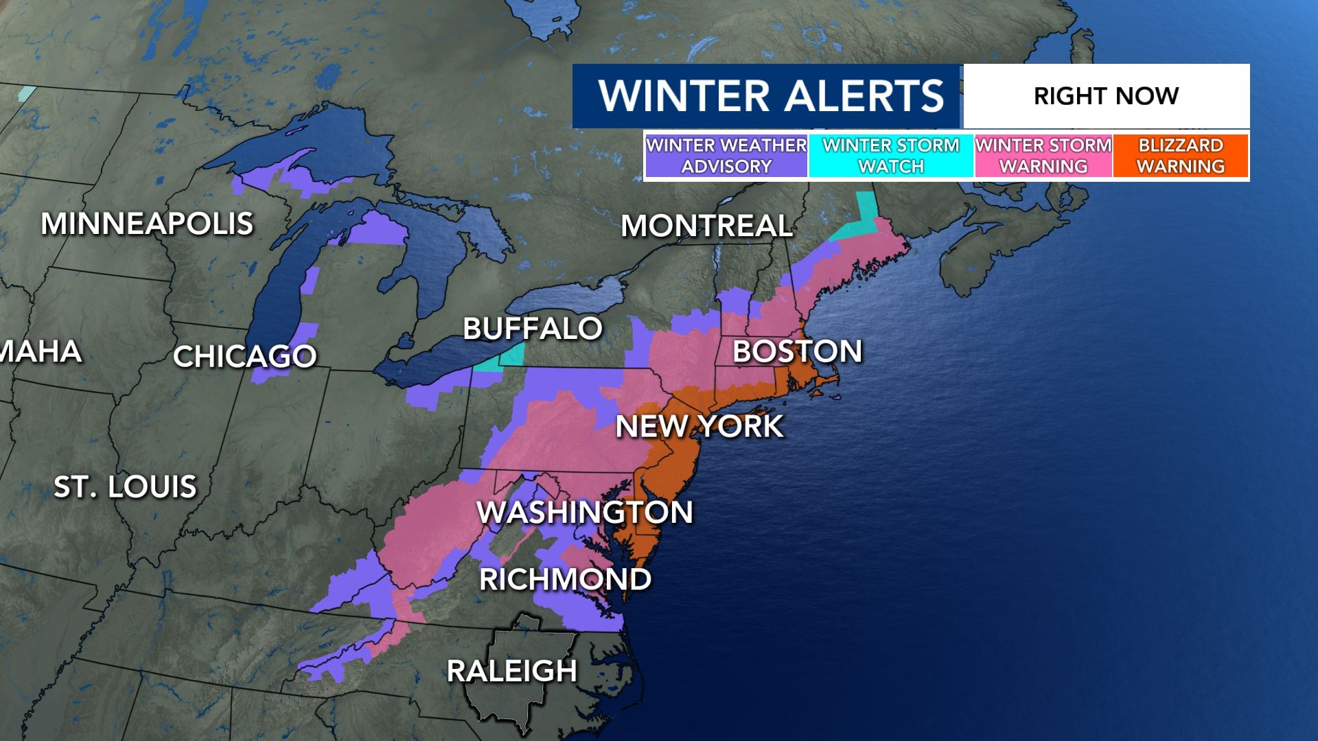
Blizzard warnings are in effect through Monday evening from Ocean City, Maryland to Boston, Massachusetts. The warnings are in effect for more than 35 million people, according to NOAA's Weather Prediction Center.
Other WRAL Top Stories
This includes areas like New York City, Long Island and New Haven, Connecticut as well.
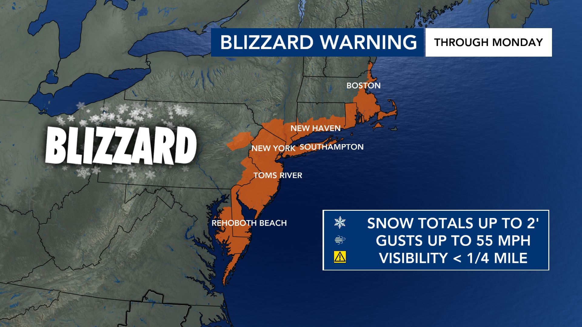
It's the Big Apple's first blizzard warning since 2017.
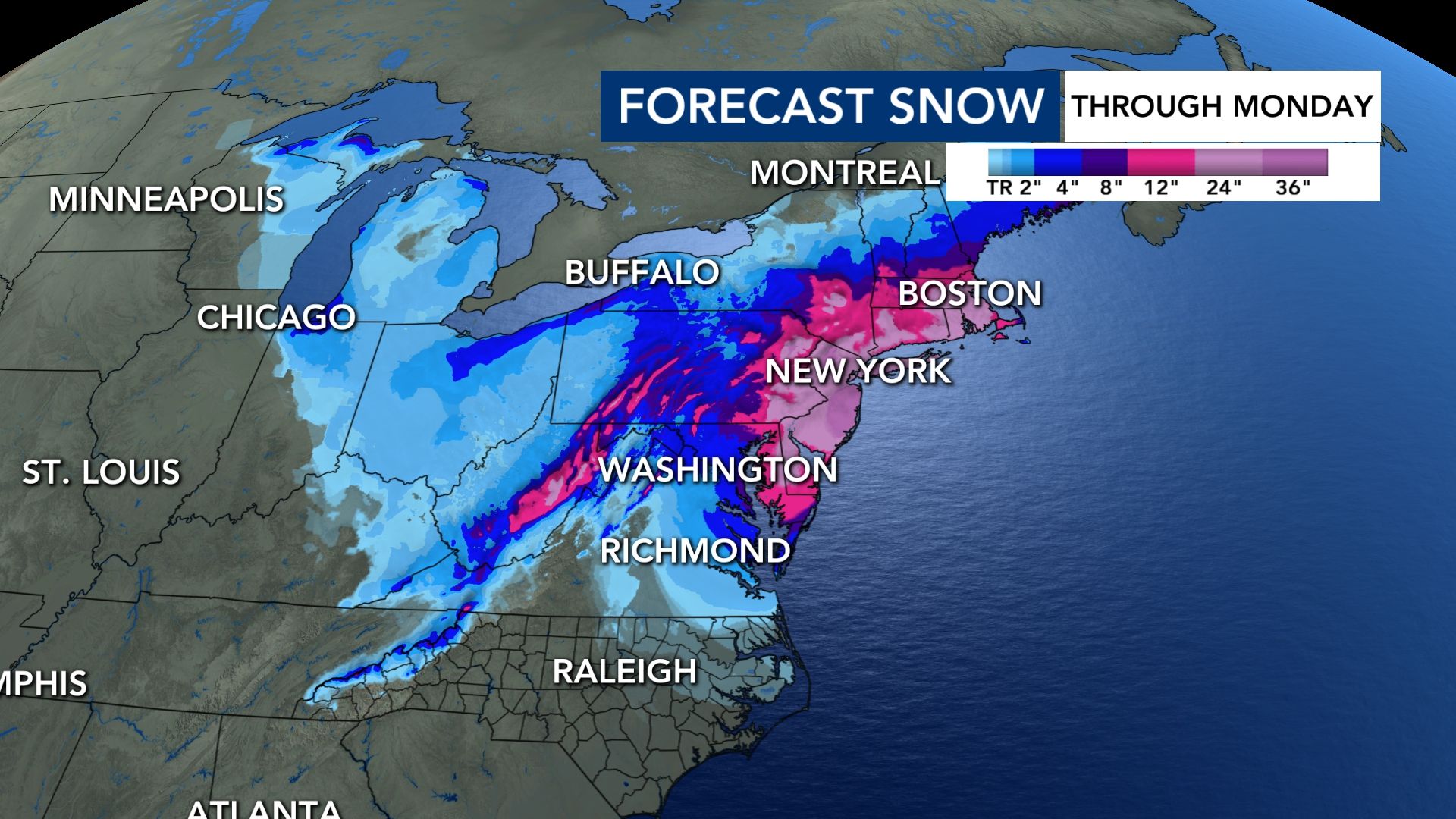
Forecast snow totals approach and exceed a foot-and-a-half in parts of the Tri-State area. The local NBC affiliate in Boston is forecasting pockets of 18 to 24 inches of snow too.
The National Weather Service in Mount Holly posted early Sunday morning, "Regardless of exactly how much snow falls, the message is the same: life-threatening travel is expected and crippling impacts to infrastructure could last beyond Monday."
Snow rates of 2 to 3 inches per hour are possible. Gusts within the blizzard can range between 40 mph and 70 mph, resulting in power outages from New Jersey to New England.
Coastal flooding and erosion is also possible from Delaware to New England.
Other winter weather alerts stretch far beyond the blizzard warnings.
In fact, some of the North Carolina mountains are under winter storm warnings and winter weather advisories through Monday evening.
Closer to home, we may see a brief period of wet snow mainly north and east of the Triangle Sunday. This would be between 5 p.m. and 10 p.m.
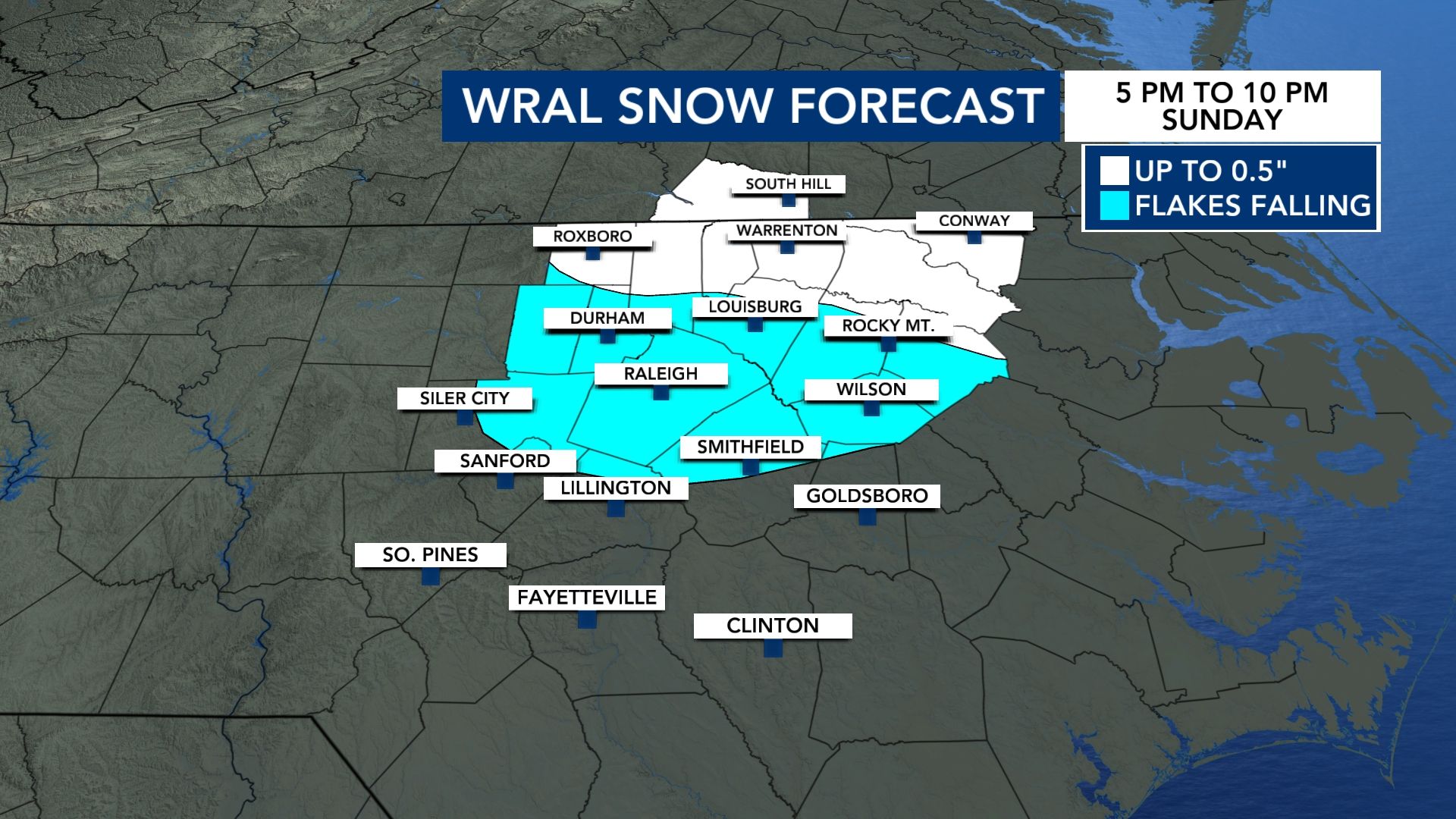
If there's any accumulation, it would be closer to the Virginia state line, on the grass and less than a half-an-inch.