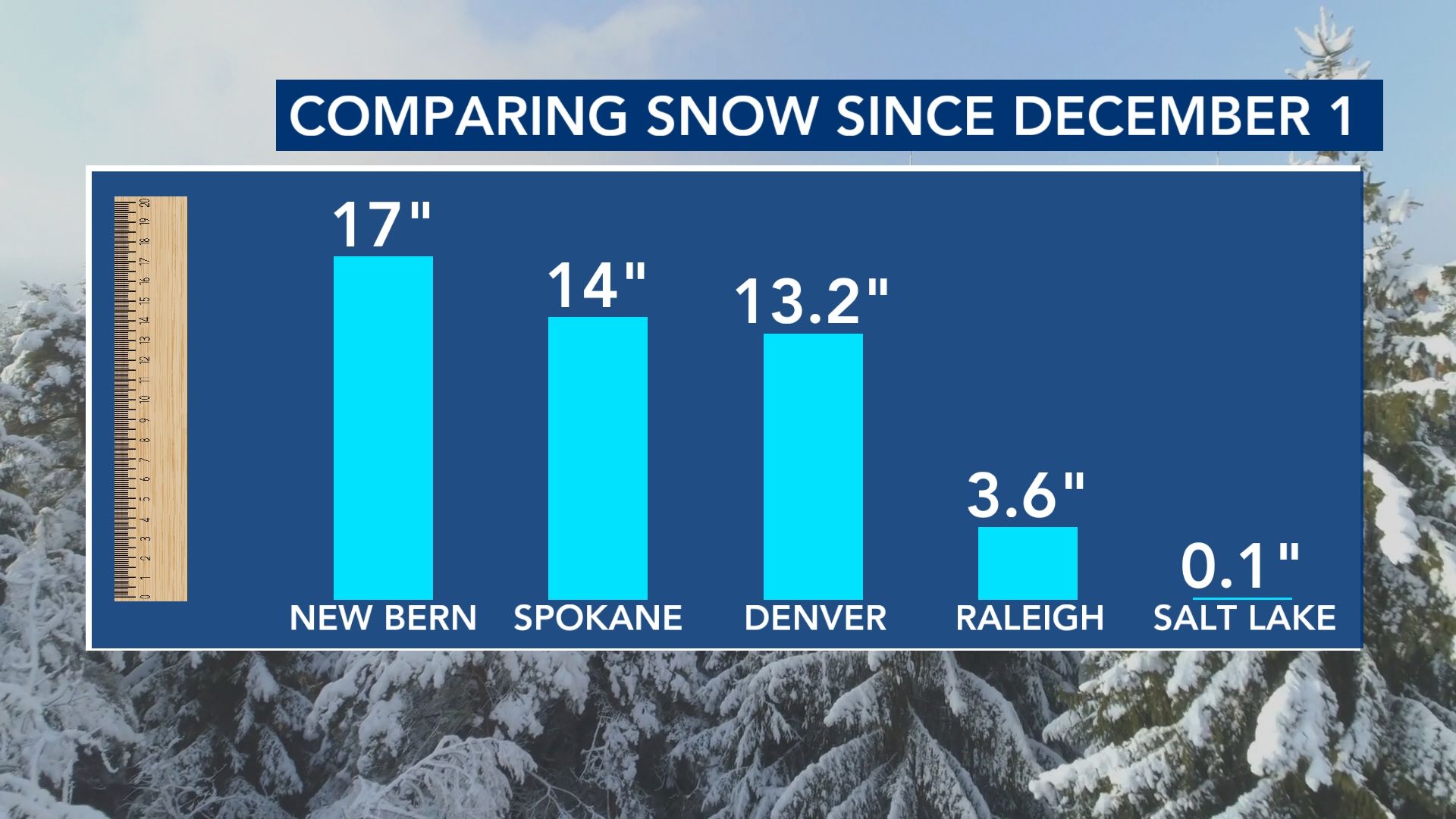
This past weekend, parts of North Carolina - specifically the coast - saw historic snow. In an odd twist of fate, that now puts areas like New Bern ahead of Denver, Salt Lake City and Spokane for snowfall this winter.
Other WRAL Top Stories
But why?
High pressure vs. Low pressure
This comes down to the mean (average) upper-level pattern in the atmosphere for roughly the past month.
When you look at the snow analysis across the country, you can see the clear role that elevation has played in the Rockies, Intermountain West and Cascades.
But now, you add parts of the Southeast to the mix, and it sticks out.
Overall, high pressure has dominated over the Western U.S. in the last month while repeated rounds of low pressure have taken over the East.
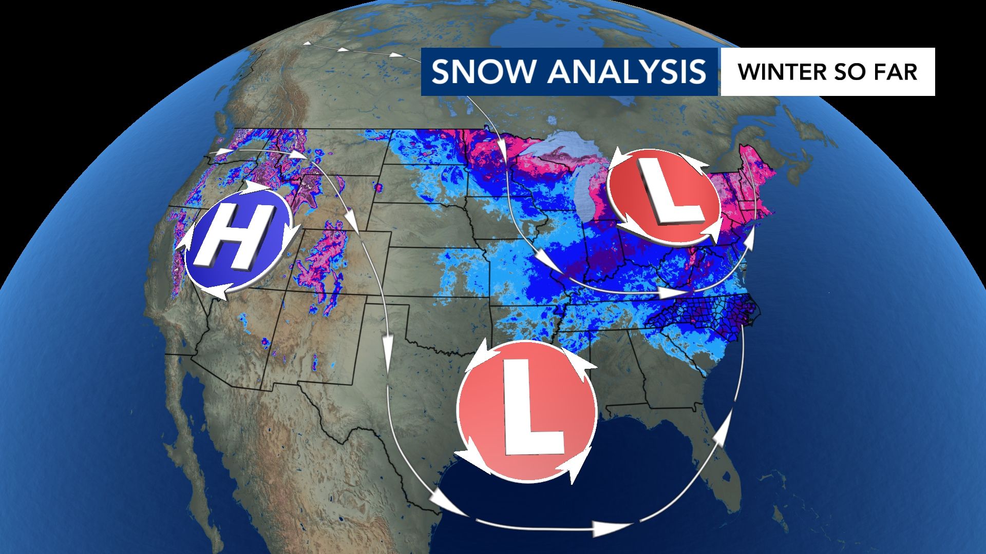
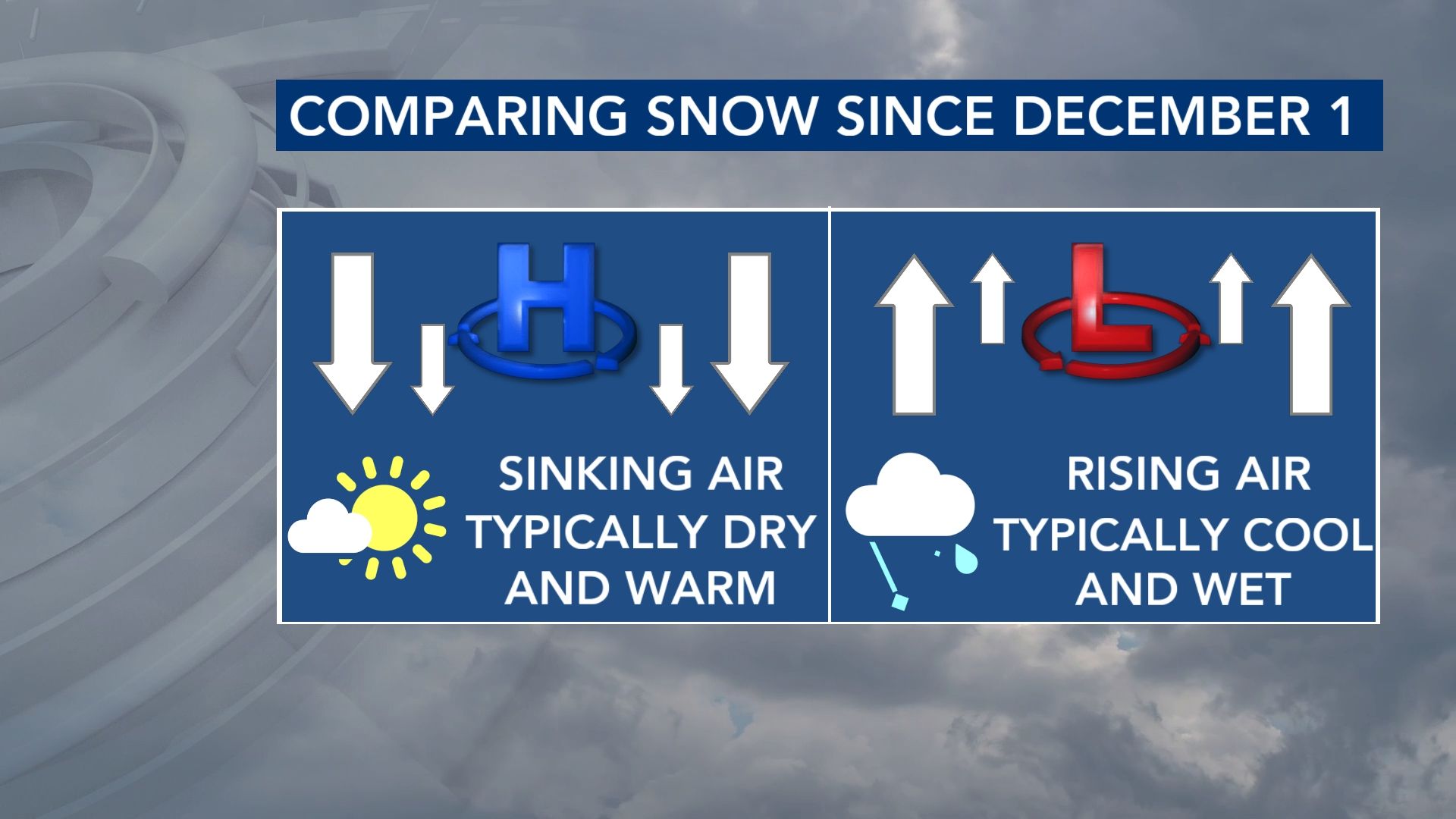
High pressure leads to sinking air, which reduces cloud cover and precipitation chances. Low pressure - on the other hand - results in rising air and a better chance of precipitation.
The air flow around the two has favored the Eastern U.S. for a cooler and wetter/wintrier pattern in the last two-to-three weeks.
The proximity to water in places like New Bern makes it possible for high snow amounts to happen when "the perfect storm" arises.
Many parts of the Outer Banks hadn't seen snow like this since 1989.