A strong cold front passes later Friday into early Saturday, which will bring some showers this evening and colder air for the weekend. It will also bring very gusty winds across North Carolina.
Let's dive into what will cause our strong winds for the first half of the weekend.
Other WRAL Top Stories
The cold front passes at the surface by early Saturday, and as that front continues to move south and east, very cold air above the surface will also dive into the area.
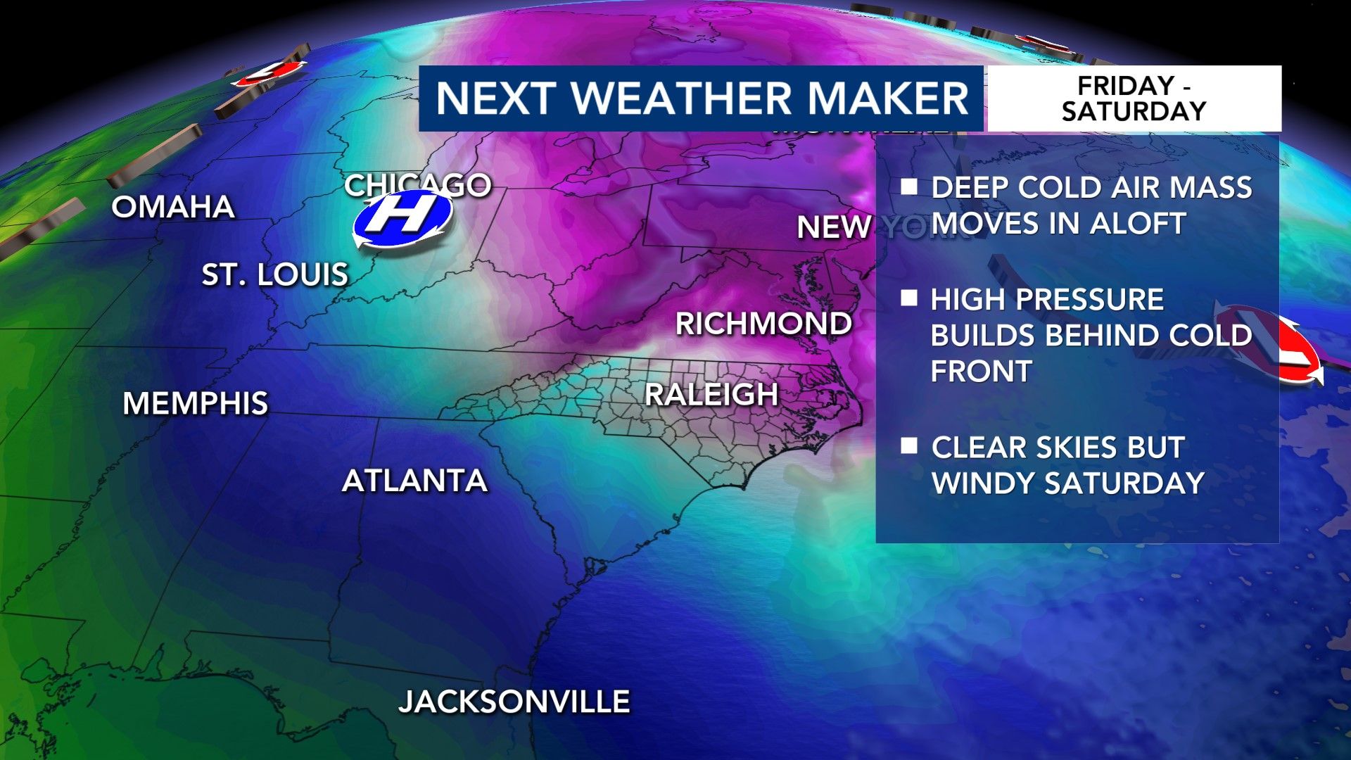
During the daytime on Saturday, we will have clear or mostly clear skies thanks to high pressure in place. High pressure promotes sinking air and dry conditions.
The sun will produce radiation which will heat the surface of the Earth, and through conduction, that heat will be transferred to the air.
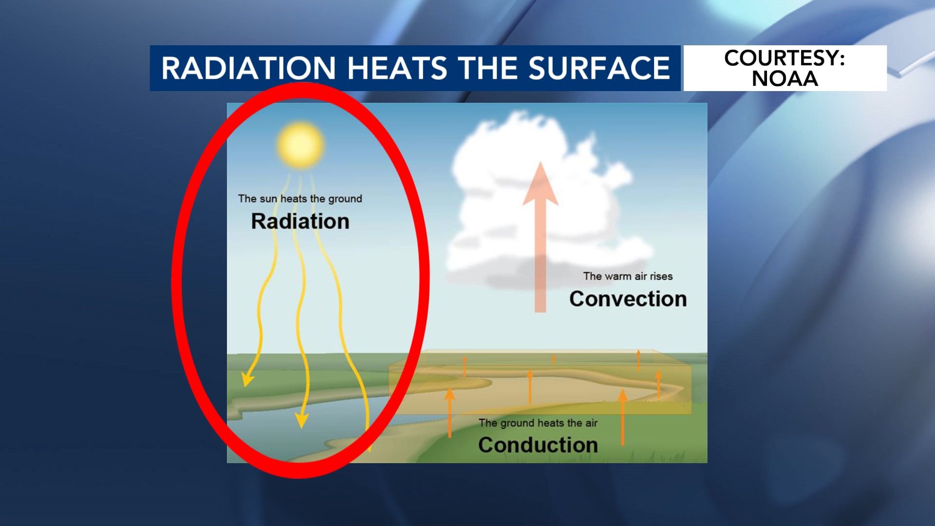
That warmer air will rise, and as that air rises, the very cold air above the surface will quickly dive down to the ground.
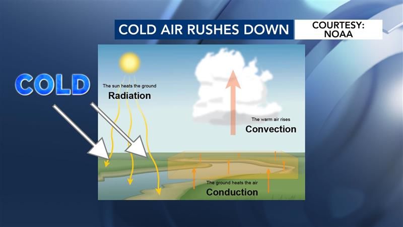
This flow between the air at the surface and the air above creates wind, and with very strong cold air mass moving through the area, that cold, dense air will move even faster than usual towards the surface.
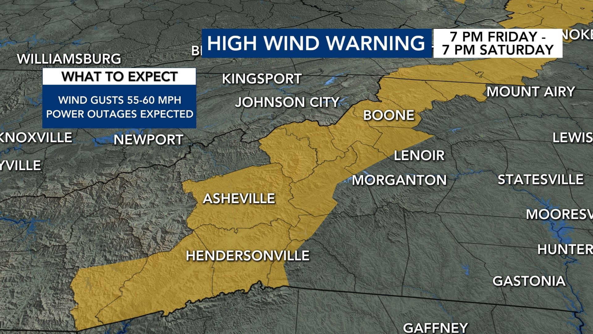
The strongest winds during the first half of the weekend will be towards the mountains. Winds will gust up to 55-60 mph, and wind chill values will drop into the negatives.
A High Wind Warning is in place from 7 p.m. Friday to 7 p.m. Saturday.
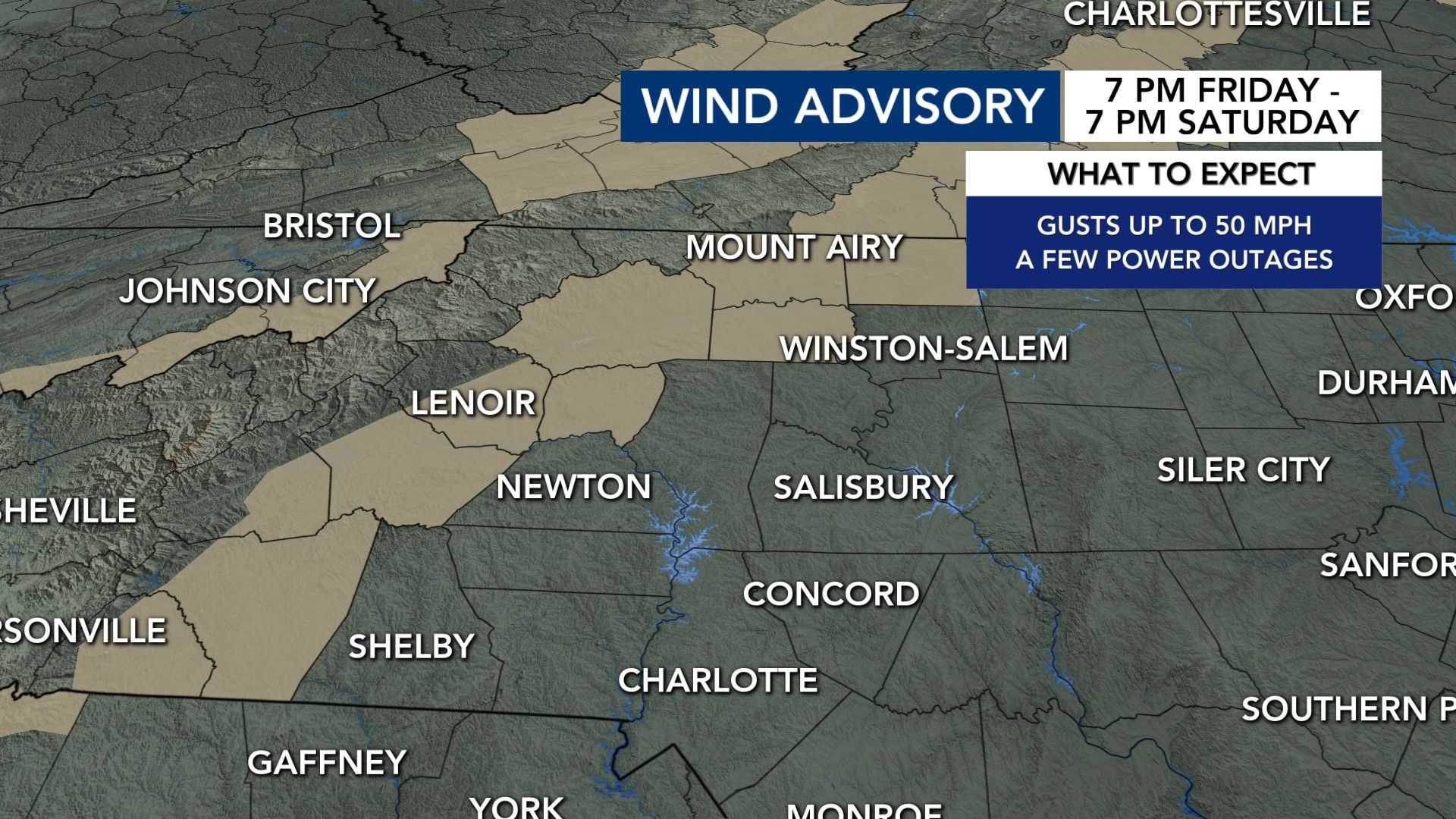
A Wind Advisory is in place for the same time frame for areas not included in the High Wind Warning but are just east of the mountains. Gusts could reach up to 50 mph there.
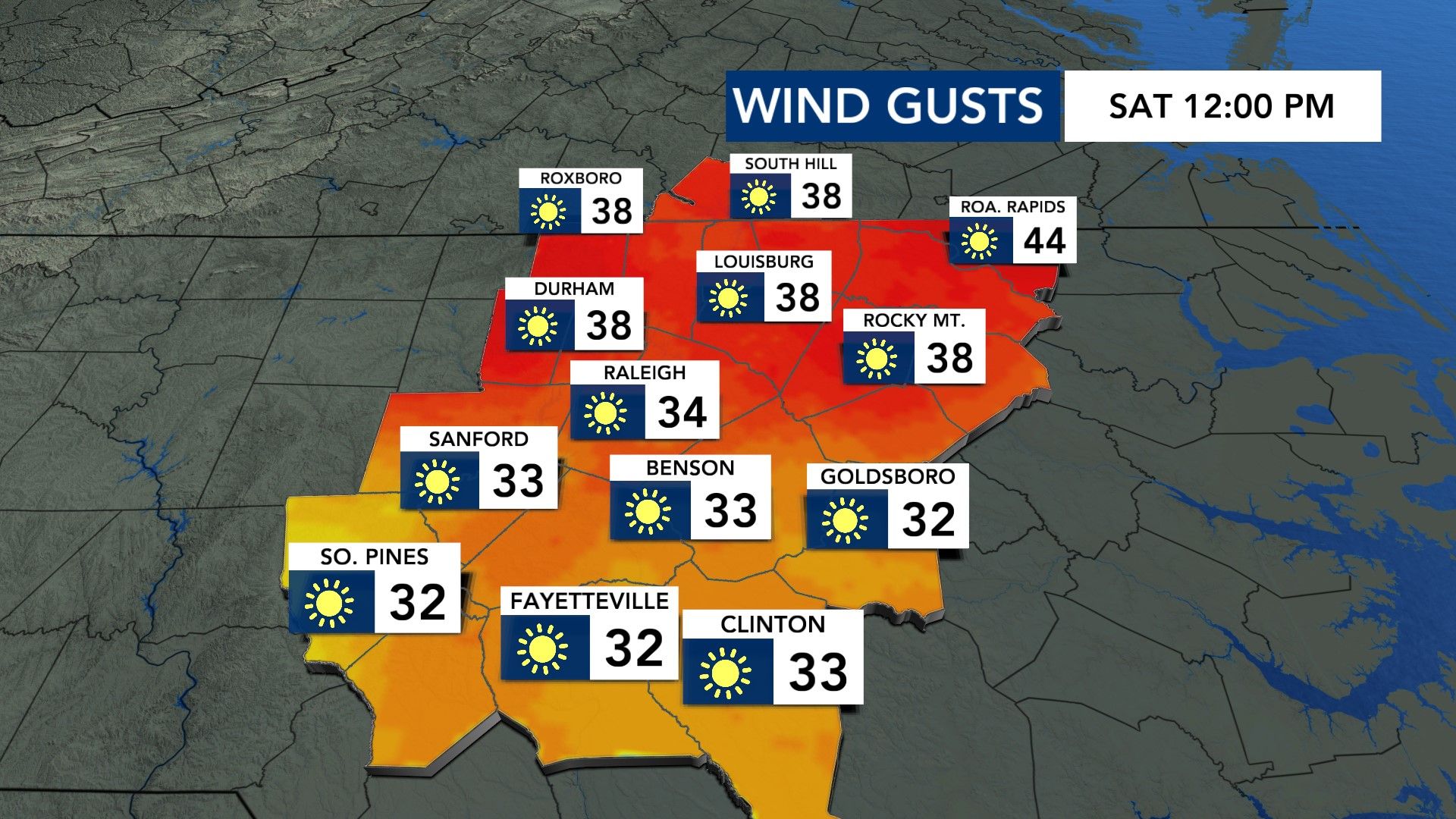
Our area will experience gusts up to 35-40 mph Saturday. Wind chill values will sit in the teens and 20s throughout the day.
Be sure to have those extra layers handy!