Satellite imagery during the height of Monday's blizzard is something that you could see on the cover of a meteorology textbook.
If you saw it, you might've taken note of what looked like an eye at the center of the storm.
Other WRAL Top Stories
"Chris, don't those only happen in hurricanes?"
Correct. This was not an eye. It's actually a common occurrence in land-based storms that move over water. It's due to a process known as warm air seclusion.
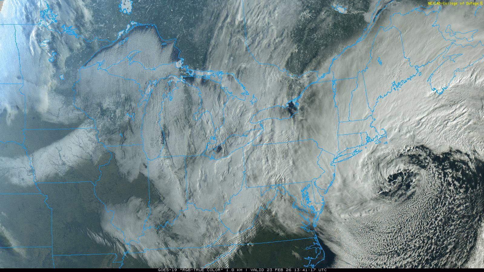
How does the eye of a hurricane form?
The eye of a hurricane is that calm of the storm. It's a narrow area of clearing in a sea of chaos.
The air at the center of a tropical system is sinking.
When air sinks, it warms and it dries. Therefore, the compression that leads to that warming and drying is what allows the sky to be clear.
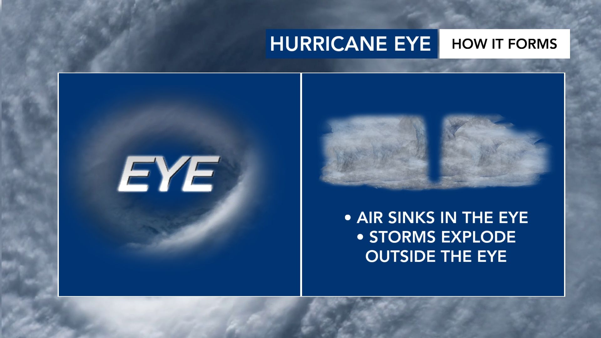
What happened during the Blizzard of '26, then?
At the center of the Blizzard of '26, you had different processes going on. These processes are "baroclinic" in nature, referring to the difference in temperature as you go from west to east across a storm system.
During the mature phase of a storm, the air is wrapping around the western flank. This will essentially trap warmer air at the center of the storm, allowing it to clear out. This is your warm air seclusion.
One of the key differences between this and the eye of a hurricane is the lack of thunderstorm activity around the center of the storm. In fact, while the air sinks at the center of a tropical system - it does the opposite at the center of a non-tropical storm. The air rises there.
Does it really matter?
I'm of the belief that it does matter. Yes, it may have the appearance of a hurricane based on its clearing center. However, there are different behaviors between a hurricane and a nor'easter/blizzard.
Calling something like this a "snowicane" doesn't do anything to communicate the impact of the storm. Rather, it takes away from the seriousness of the impacts at ground level.