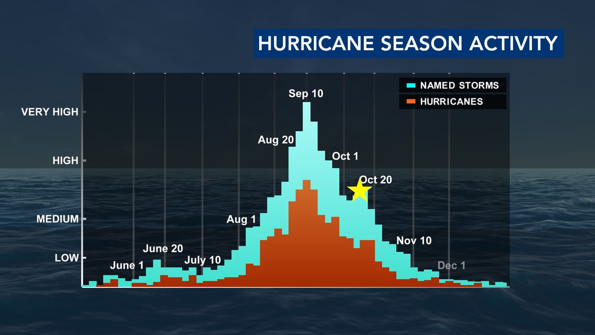
We are more than halfway through the hurricane season and most storms have stayed out to sea. Some storms remained just offshore and caused major issues along our coast, but the only storm that made landfall in the Carolinas was Chantal. Why did almost all the tropical systems stay offshore? There are a couple of factors that played a huge role in steering storms out to sea.
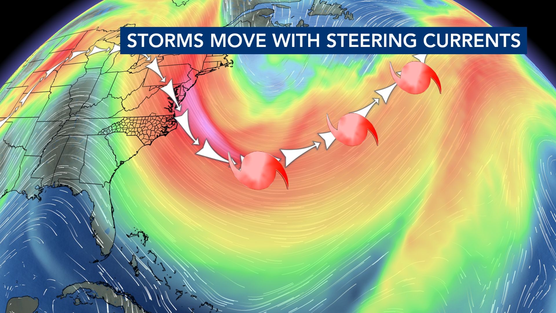
All storms are steered by upper-level winds (the jetstream). In fact, you can draw an upper-level wind pattern that connects all the way across the globe. I once had a professor task me to draw a surface map that connected all the fronts (warm fronts, cold fronts, occluded fronts). He did this to prove that everything is connected by upper-level winds. Keep in mind that the upper-level winds flow from west to east. If a storm approaches the east coast and runs into upper-level winds, it will eventually stop its westward progress and turn to the east. This is what happened with most of our storms this season. We had enough troughs (dip in the jetstream/upper-level winds) that aided in steering storms away from us.
Other WRAL Top Stories
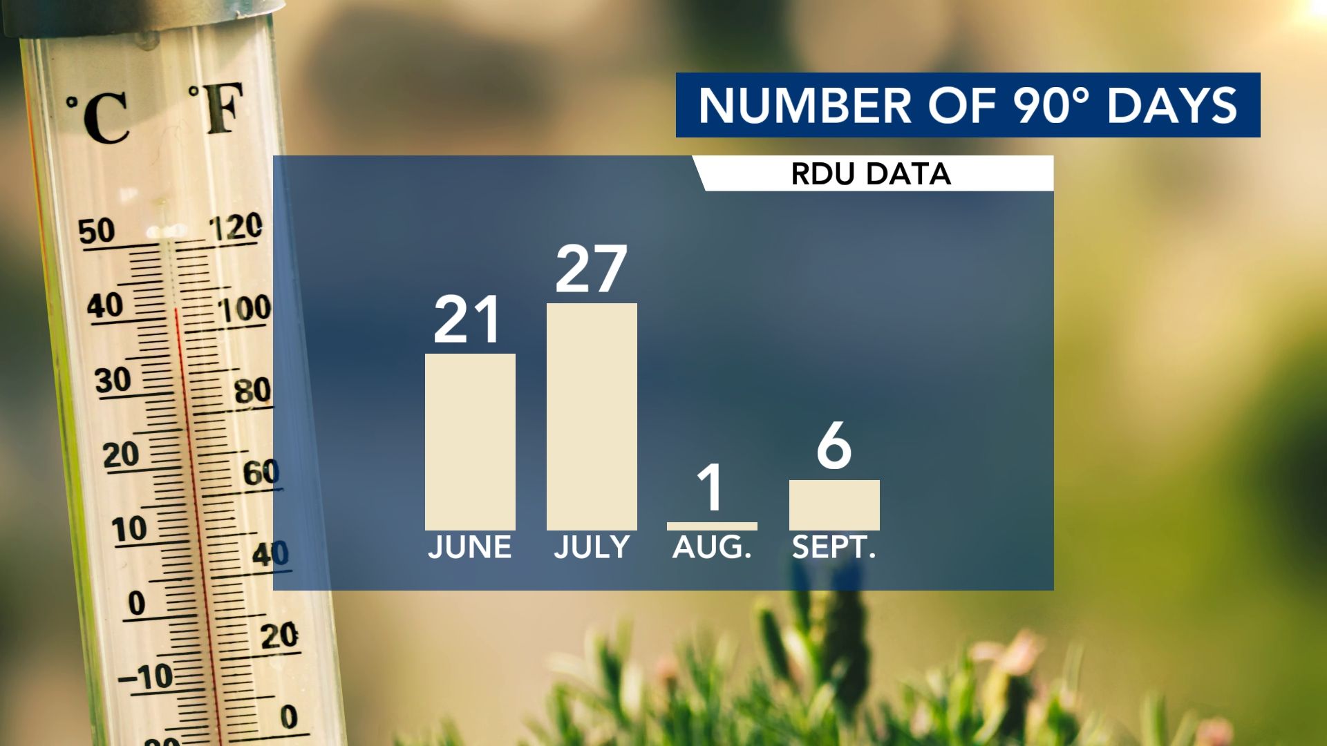
Troughs or dips in the jetstream typically come with cold fronts. And during our peak hurricane season (August through September), we had several fronts swing through and that kept temperatures down. Cooler temperatures mean less fuel for tropical systems. The cooler temperatures also played a role in keeping systems away from us. We went from 27 days in the 90s during the month of July, to only one day in the 90s during August.
With about a month and a half to go, it’s still important to stay alert and prepared. The good news is that ocean temperatures are trending cooler thanks to recent upwelling, and historically, late-season storms are few and far between. If these patterns hold, the Carolinas may be able to close out the season on a quiet note.