
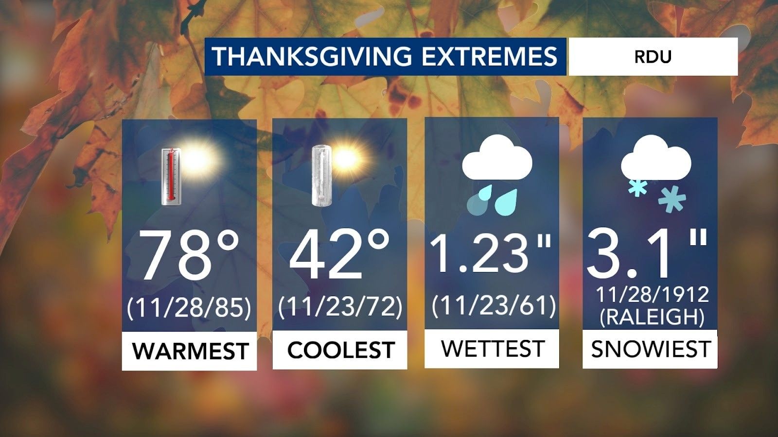
Thanksgiving weather in North Carolina can be, well, just about anything.
In Raleigh, highs have ranged from nearly 80 degrees to the low 40s, and we’ve seen everything from soaking rain to measurable snow, including 3.1 inches back in 1912.
Other WRAL Top Stories
With Thanksgiving still two weeks away, it’s too early for a precise holiday forecast. Accuracy drops significantly beyond about seven days. Instead, long-range outlooks help us understand broad patterns and what’s more or less likely as we get closer to the holiday.
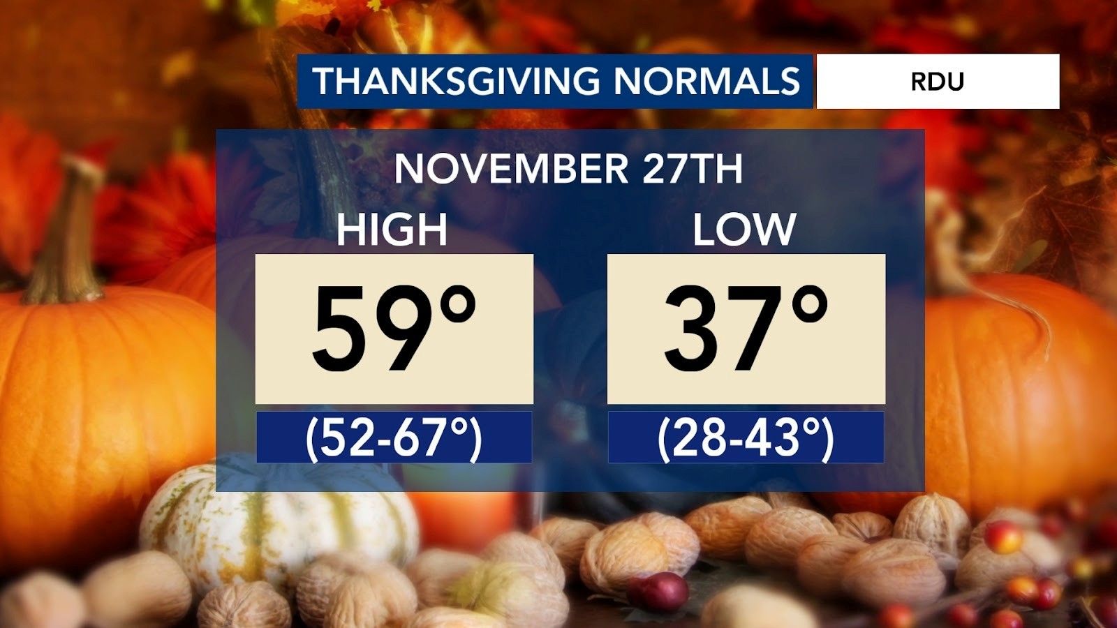
This year, Thanksgiving falls on Thursday, Nov. 27th.
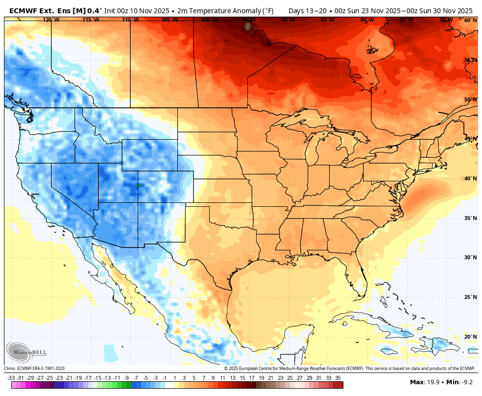
The Climate Prediction Center is calling for above-normal temperatures and below-normal rainfall across most of North Carolina during Thanksgiving week.
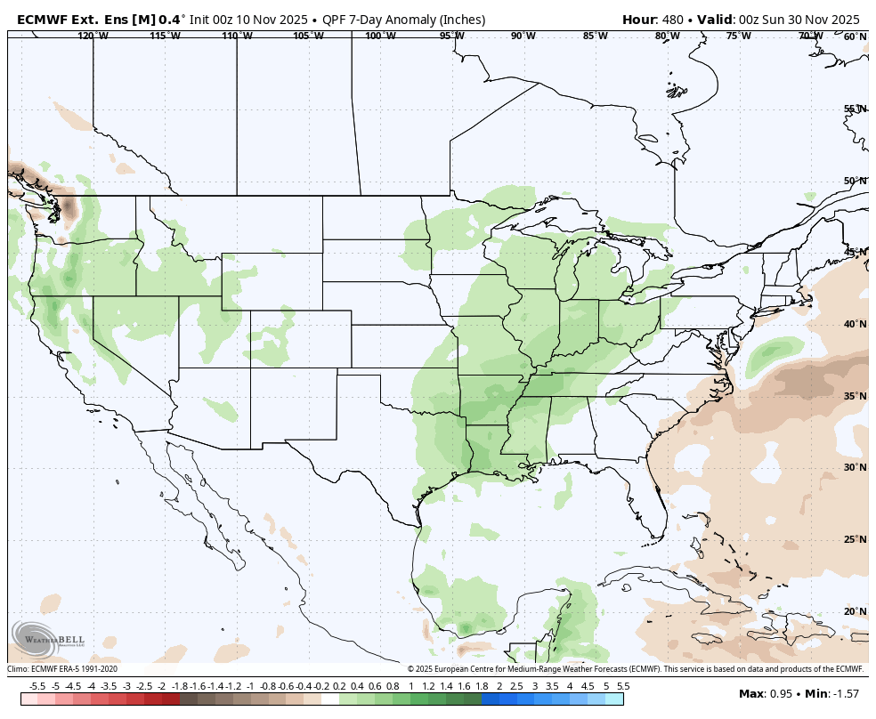
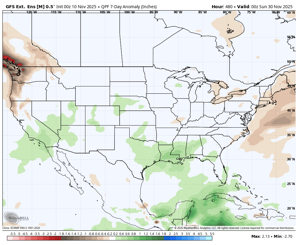
What really caught my attention is an area of above-normal precipitation just to our west, centered over the Midwest. That stands out for two reasons:
- A storm system in that region could impact holiday travel.
- Depending on how it evolves, parts of that system could eventually move east.
Whether it crosses the mountains is still a big question mark because it’s simply too early to know. But it’s something worth watching, especially since both the European and American ensemble models highlight a wetter pattern from the Midwest into the Deep South during the week of Thanksgiving.
Temperature-wise, our first batch of ensemble data released today continues to show above-normal temperatures for much of the week, perhaps nearing near-normal by the holiday.
It’s an early look, but if you enjoy following seasonal trends, I hope this mini-discussion helped break down where things stand. I’ll post a fresh update early next week regarding the forecast.